 Lists
Lists Lists
ListsCollection items
![[img]](http://www.humbox.ac.uk//697/1/PHI_01018-sweden.jpg)
|
Early Maps: Sweden by Olaf Rudbeck (1679)
Map of Sweden drawn by the Swedish scientist and writer Olaf Rudbeck in 1679. The map claims Sweden as Atlantis. Map used for description and travel. The original copy of this image can be found at the Roderic Bowen Library and Archives, University of Wales Lampeter.
Shared with the World by Dr Matt Phillpott |
|
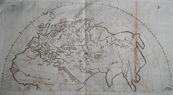
![[img]](http://www.humbox.ac.uk//700/1/PHI_00495-Europe.jpg)
|
Early Maps: Munster, Europe (1575)
A map of Munster drawn in 1575. Used for description and travel. The original copy of this image can be found at the Roderic Bowen Library and Archives, University of Wales Lampeter.
Shared with the World by Dr Matt Phillpott |
|
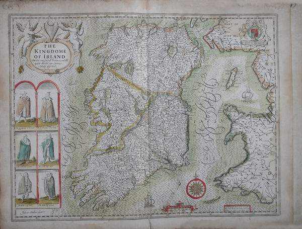
![[img]](http://www.humbox.ac.uk//656/1/PHI_00234-Kingdome_of_Ireland.jpg)
|
Early Maps: Kingdom of Ireland (1610)
Map of the Kingdom of Ireland drawn by the English historian and cartographer John Speed in 1610. The map was used for description and travel. The original copy of this image can be found at the Roderic Bowen Library and Archives, University of Wales Lampeter.
Shared with the World by Dr Matt Phillpott |
|
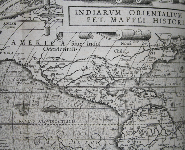
![[img]](http://www.humbox.ac.uk//664/1/PHI_00898_America.jpg)
|
Early Maps: America by Givanni Maffei (1589)
Map of America, part of a drawing of the world by the Italian Givanni Maffei. Published in 1589. Used for exploration and discovery. The original copy of this image can be found at the Roderic Bowen Library and Archives, University of Wales Lampeter.
Shared with the World by Dr Matt Phillpott |
|
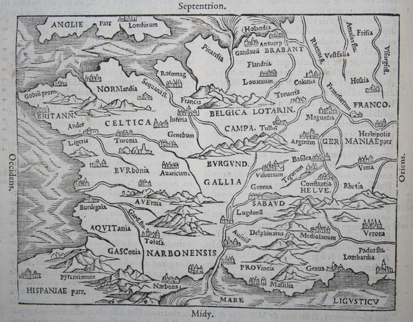
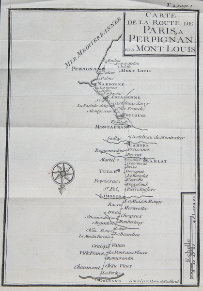
![[img]](http://www.humbox.ac.uk//696/1/PHI_04444-ParisPerpignan.jpg)
|
Early Maps: France by Jean-Aimar Piganiol de la force
An eighteenth-century map of France by Jean-Aimar Piganiol de la force. Used for description and travel. The original copy of this image can be found at the Roderic Bowen Library and Archives, University of Wales Lampeter.
Shared with the World by Dr Matt Phillpott |
|
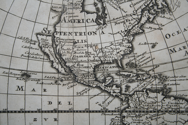
![[img]](http://www.humbox.ac.uk//698/1/ODS_01455-California.jpg)
|
Early Maps: California, America (1676)
Map of California (America) drawn in 1676. Used for description and travel. The original copy of this image can be found at the Roderic Bowen Library and Archives, University of Wales Lampeter.
Shared with the World by Dr Matt Phillpott |
|
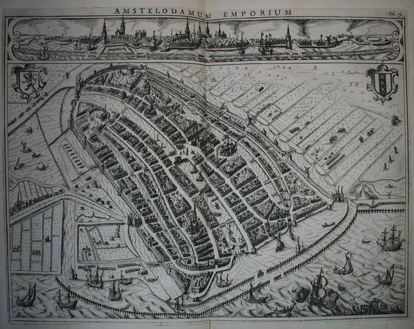
![[img]](http://www.humbox.ac.uk//663/1/PHI_04872-Amstelodamum_Emporium.jpg)
|
Early Maps: Amsterdam by Johannes Isacius Pontanus (1611)
Map of Amsterdam drawn by Johannes Isacius Pontanus in 1611. Used for exploration and discovery. The original copy of this image can be found at the Roderic Bowen Library and Archives, University of Wales Lampeter.
Shared with the World by Dr Matt Phillpott |
|
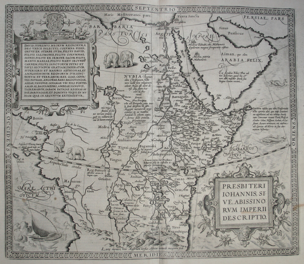
![[img]](http://www.humbox.ac.uk//699/1/PHI_00231-Prester_John.jpg)
|
Early Maps: Abyssinia by Abraham Ortelius (1606)
A map of the kingdom of Abyssinia belonging to the mythical Christian king, Prester John. Drawn by Abraham Ortelius and published in 1606. The original copy of this image can be found at the Roderic Bowen Library and Archives, University of Wales Lampeter.
Shared with the World by Dr Matt Phillpott |
|
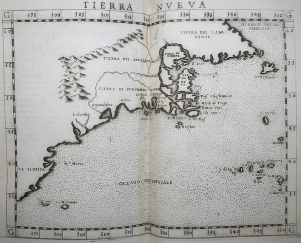
![[img]](http://www.humbox.ac.uk//659/1/PHI_03081-Tierra_Nueva.jpg)
|
Early Maps: Tierra Nueva by Girolamo Ruscelli (1561)
Map of Tierra Nueva (New England/The East coast of North America) drawn by the Italian Alchemist, physician and cartographer Girolamo Ruscelli in 1561. Based upon a 1548 map published in Giacomo Gastaldi's La Geografia. The original copy of this image can be found at the Roderic Bowen Library and Archives, University of Wales Lampeter.
Shared with the World by Dr Matt Phillpott |
|
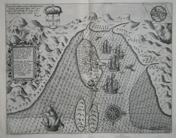
![[img]](http://www.humbox.ac.uk//658/1/PHI_04857-Mozambique.jpg)
|
Early Maps: Mozambique by Jan Hugen van Linschoten (1599)
Map of Mozambique drawn by the Dutch Protestant merchant, traveller and historian Jan Hugen van Linschoten in 1599. Used for exploration and discovery. The original copy of this image can be found at the Roderic Bowen Library and Archives, University of Wales Lampeter.
Shared with the World by Dr Matt Phillpott |
Collection of early maps
A collection of early maps used for description, travel, discovery and exploration. Provided by Peter Hopkins, Roderic Bowen Library and Archives, University of Wales Lampeter.
| Added By: | Dr Matt Phillpott |
|---|---|
| Date Added: | 22 Sep 2009 15:21 |
| Creators: | Matt Phillpott |
| Tags: | Ukoer, Oerhist, History, Map, Travel, Discovery, Exploration |
| Languages: | English |
| Viewing permissions: | World |
| URL: | http://www.humbox.ac.uk/id/eprint/701 |
| Downloads & Views |
Actions (login required)
 |
View Item |


